
Images
Download file
wroclaw_tactile_map_2025.zip, format: ZIP, size: 3.0 MB
Description
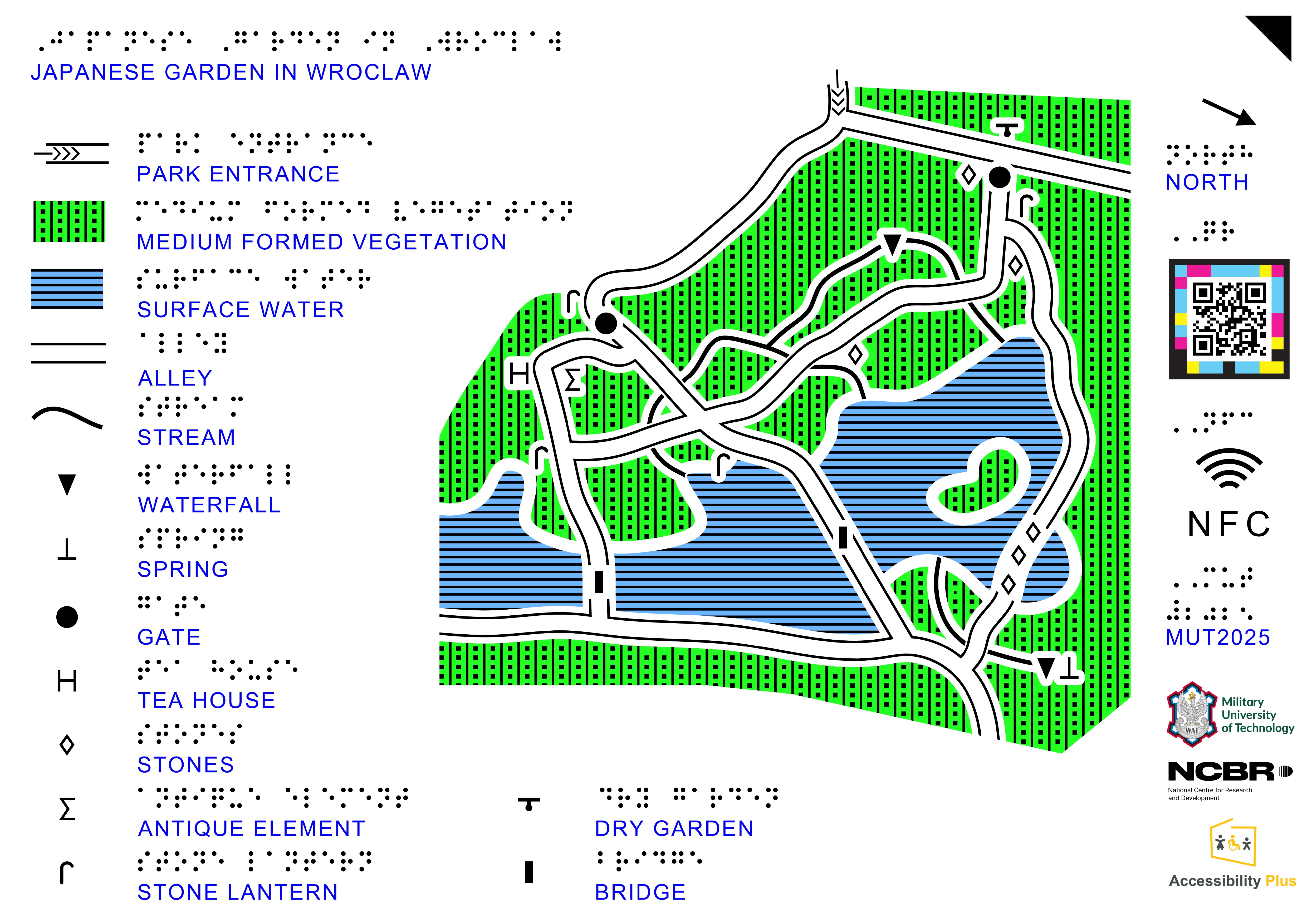
This 3D model presents a layered spatial representation of the Japanese Garden in Japanese Garden, Wrocław, designed for tactile visualization and UV printing technology.
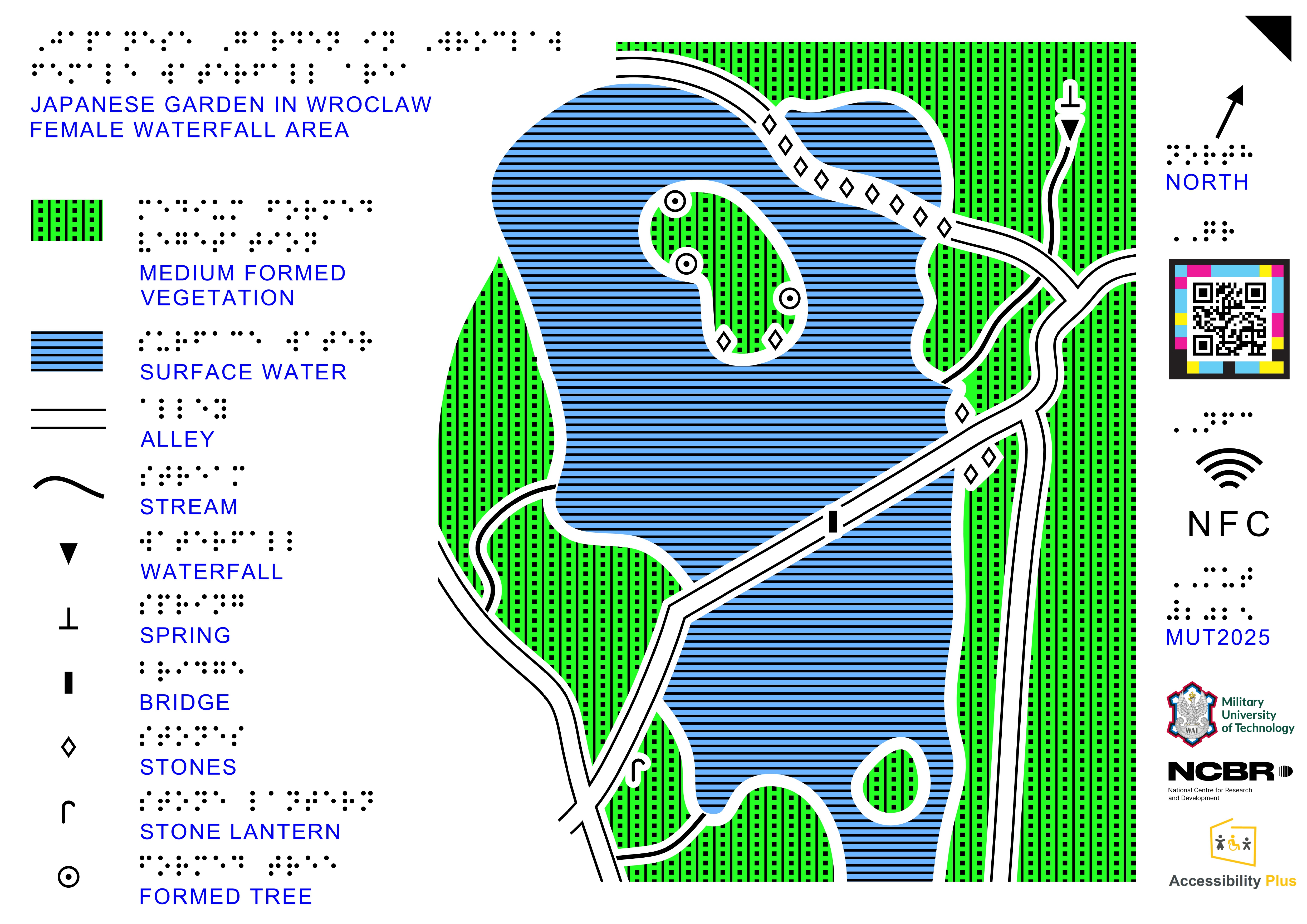
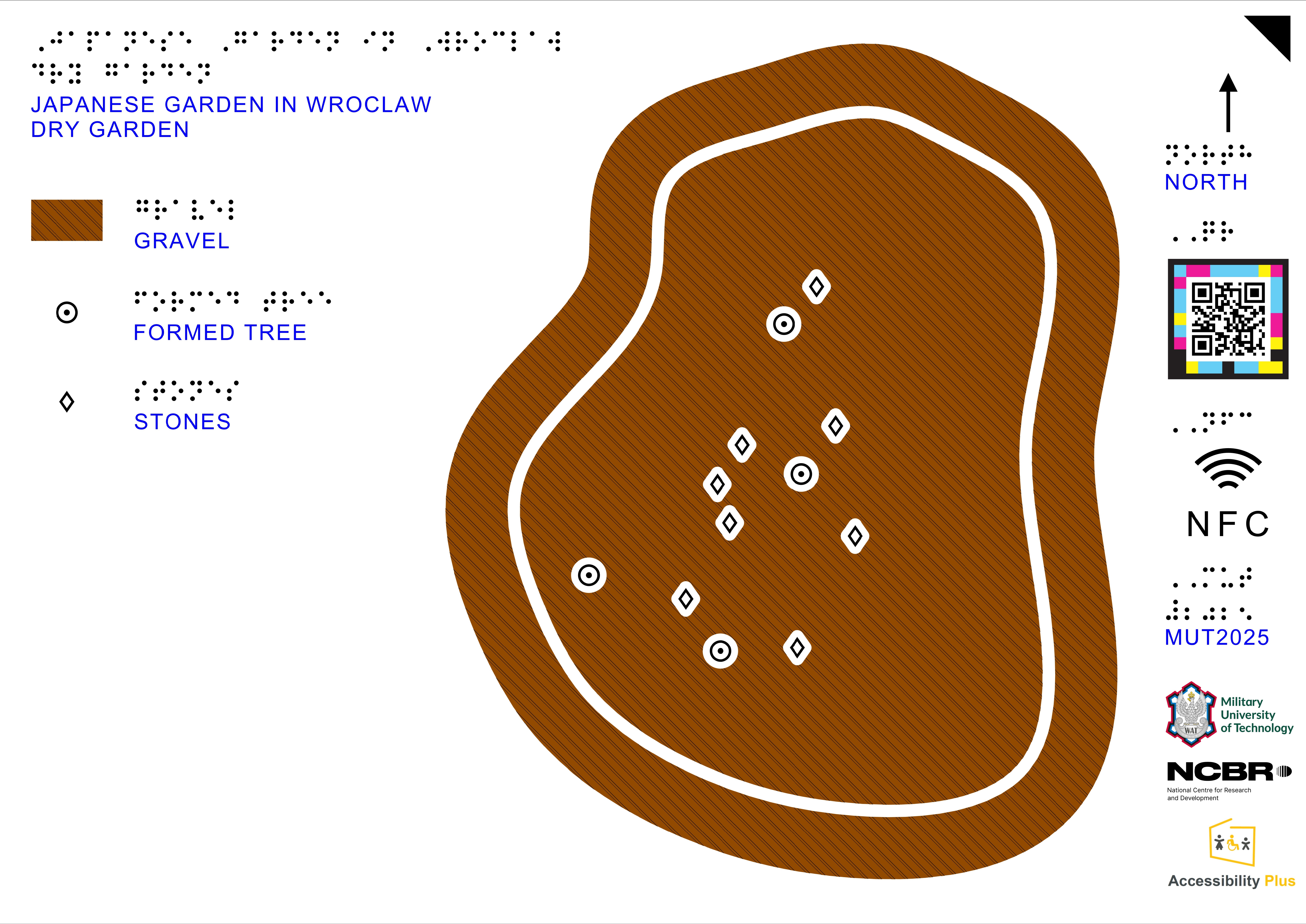
The model consists of three map levels, each showing the garden at a different scale and level of detail.
- Level 1 presents a general plan of the entire Japanese Garden located within Szczytnicki Park, providing the broader spatial context and overall layout of the garden.
- Level 2 shows a more detailed map of the area around the garden’s waterfall, illustrating nearby paths, water features, and surrounding landscape elements.
- Level 3 presents a detailed map of the dry garden, highlighting its characteristic composition of stones, gravel, and carefully arranged vegetation typical of this type of Japanese garden design.
The model was prepared specifically for UV printing, using a layered structure that represents spatial hierarchy and selected landscape elements through differences in elevation. The project includes PDF files for each printable layer, corresponding to the following thickness levels: 0.5 mm, 0.8 mm, 1.0 mm, 1.5 mm, 2.0 mm and 2.2 mm. Additionally, the set contains a full-color base layer, which serves as the visual background for the UV-printed relief layers.
Model data
| Author / creator | Military University of Technology |
|---|---|
| Uploaded by | T-rep admin |
| Categories | Culture, Nature, Architecture, History |
| Application | Tactile map |
| Recommended production technique | UV printing |
| Model language | English |
| Model dimensions | 420 x 297 mm |