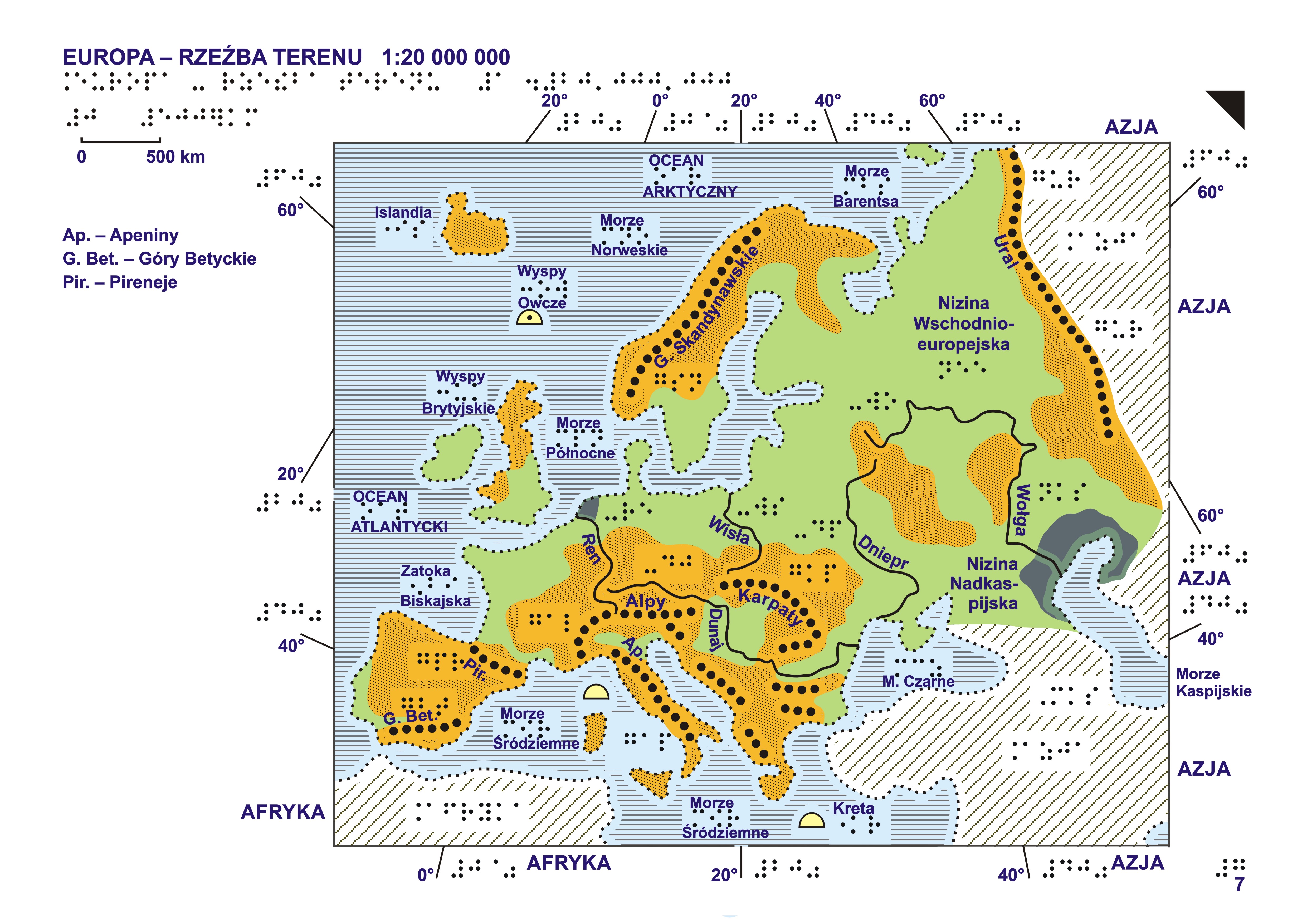
This tactile model represents the Europe – Relief Map (scale 1:20,000,000) from the Geographic Atlas of Europe for Blind and Visually Impaired Users, developed by the Head Office of Geodesy and Cartography (GUGiK). The atlas was originally published in 2006 and designed for production on swell (microcapsule) paper. It contains 46 tactile map sheets covering the geography of Europe, including thematic maps of the continent and detailed regional maps.
The model presented here is one map from the complete atlas. The full collection of maps, together with the original source files, is available here: [link to the complete atlas].